
Speed maps now in the Cambridge Digital Library
John Speed’s Theatre of the Empire of Great Britaine is one of the world’s great cartographic treasures. Published in 1611/12, it marked the first time that comprehensive plans of English and Welsh counties and towns were made available in print.
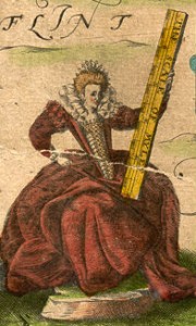
Elizabeth I from the map of Cheshire
Cambridge University Library is home to one of only five surviving proof sets of maps, made prior to the publication of the first edition of the atlas. All of these sets differ in their composition and notably the Cambridge copy includes a map of Cheshire, dated 1603 and featuring a portrait of Queen Elizabeth, which was entirely re-drawn for the published atlas and as such is one of only two copies known to exist.
Now digital images of these maps that had been taken to celebrate the 400th anniversary of the publication of the atlas have been incorporated into the Cambridge Digital Library providing a greatly enhanced viewing experience and the ability to view them in higher resolution than ever before.
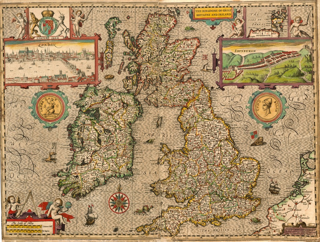
Map of Great Britain
The collection of proof maps, bought by the University Library in 1968 and known as the Gardner copy after its previous owner (Eric Gardner), is now considered priceless. It contains a single sheet for each county of England and Wales, plus a map of Scotland and each of the four Irish provinces, and paints a rich picture of the countryside at the turn of the 17th century.
Viewed through PC, tablet or smartphone these maps offer a slice of Tudor and Jacobean life in miniature. Rivers wriggle through the landscape, towns are shown as huddles of miniature buildings, woods and parks marked by tiny trees and – with contour lines yet to be invented – small scatterings of molehills denote higher ground.
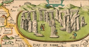
Stonehenge from the map of Wiltshire
The countryside bursts with human life: a ploughman and his two-horse team are at work in fields outside Worcester, early tourists can be seen viewing Stonehenge in Wiltshire, a group of bathers enjoy the Roman spa at Bath, and the seas around Britain teem with fabulous sea monsters and ships in full sail.
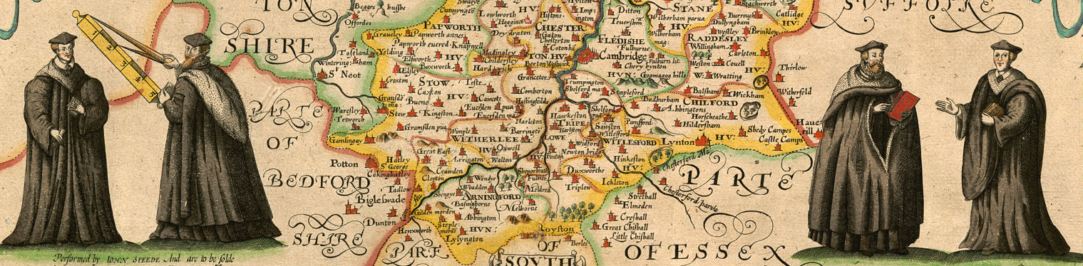
The Cambridgeshire sheet includes portraits of robed academics, a pair of them holding the map’s scale bar, as well as 24 coats of arms of the University, colleges and local nobility.
The Theatre was an immediate success: the first print run of around 500 copies must have sold quickly because many editions followed and, by the time of the 1627 edition, the atlas cost 40 shillings. It was a supreme achievement in British cartography – used by armies on both sides of the English Civil War – making John Speed into one of the most famous of all our map-makers and becoming the blueprint for folio atlases until the mid-18th century.
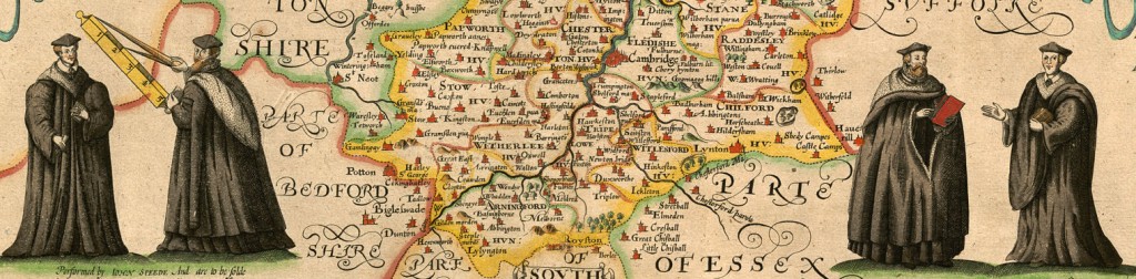
Extract from the Cambridgeshire map
I would like to purchase a printed copy of John Speed’s map no. 59 of Ulster. I don’t want a zip file or photocopy but the printed version like you have on the wall outside Digital Resources. How much will it cost ?
Thank you for your help.
Yours,
Roy Jones PhD
I am afraid that we can no longer supply printed copies at that size but if you download the image from the Cambridge Digital Library you can get a copy printed elsewhere. The originals are approximately 40 x 53 cm in size.
Pingback: A Theatre of Teasures | Cambridge University Library Special Collections
Is the date of the individual prints known?
Some of the maps have dates on them – contact me on maps@lib.cam.ac.uk and I can supply a list.
I find the content on the reverse of some of these maps as informative as the front. They can sometimes reveal more about the version. Are images available of the verso please? I am particularly interested in those of Devonshire and Cornwall. Thank you.
The proof maps illustrated here have no text on the reverse. Contact the Map Department on maps@lib.cam.ac if you would like to order images of the text on the reverse of our other copies of these maps.
Hi
I was wanting to get one of the maps (cornwall john speed) printed but the download quality isnt as good as that displayed on the website. Can I buy a print from you since the image is too blurry for a large poster. Or is there some way to download a high resolution version?
Dear Edwin,
Thanks for your interest in the Speed maps.
Our Digital Content Unit can supply high resolution digital copies of these images for which there is a charge. You can place an order here: https://www.lib.cam.ac.uk/collections/departments/digital-content-unit/ordering-images
Best wishes,
Suzanne Paul
Would it be possible to, send me the real dimensions in cms of Speed’s illustration of Stonehenge in his Wiltshire map, Gardner proof image 62? Say from the interior of the frame on the top and right-hand side, to include ‘A trenche’ on the lower edge (but not the whole of Part of Barkshire) and to the edge of the trench on the left-hand side?
The use I have in mind is an article I am preparing on the interrelationship of 6 sixteenth-century (pre-Inigo Jones) plans of Stonehenge – de Herre, Smith, RF, Rogers, van Winghe and Speed. The dimensions of the different plans are diagnostic factors. I would of course not publish or seek to publish anything without the Library’s approval and due reference.
Nick Alldridge
Nick,
A colleague will respond to you via email.
Best wishes,
Suzanne
Special Collections, CUL